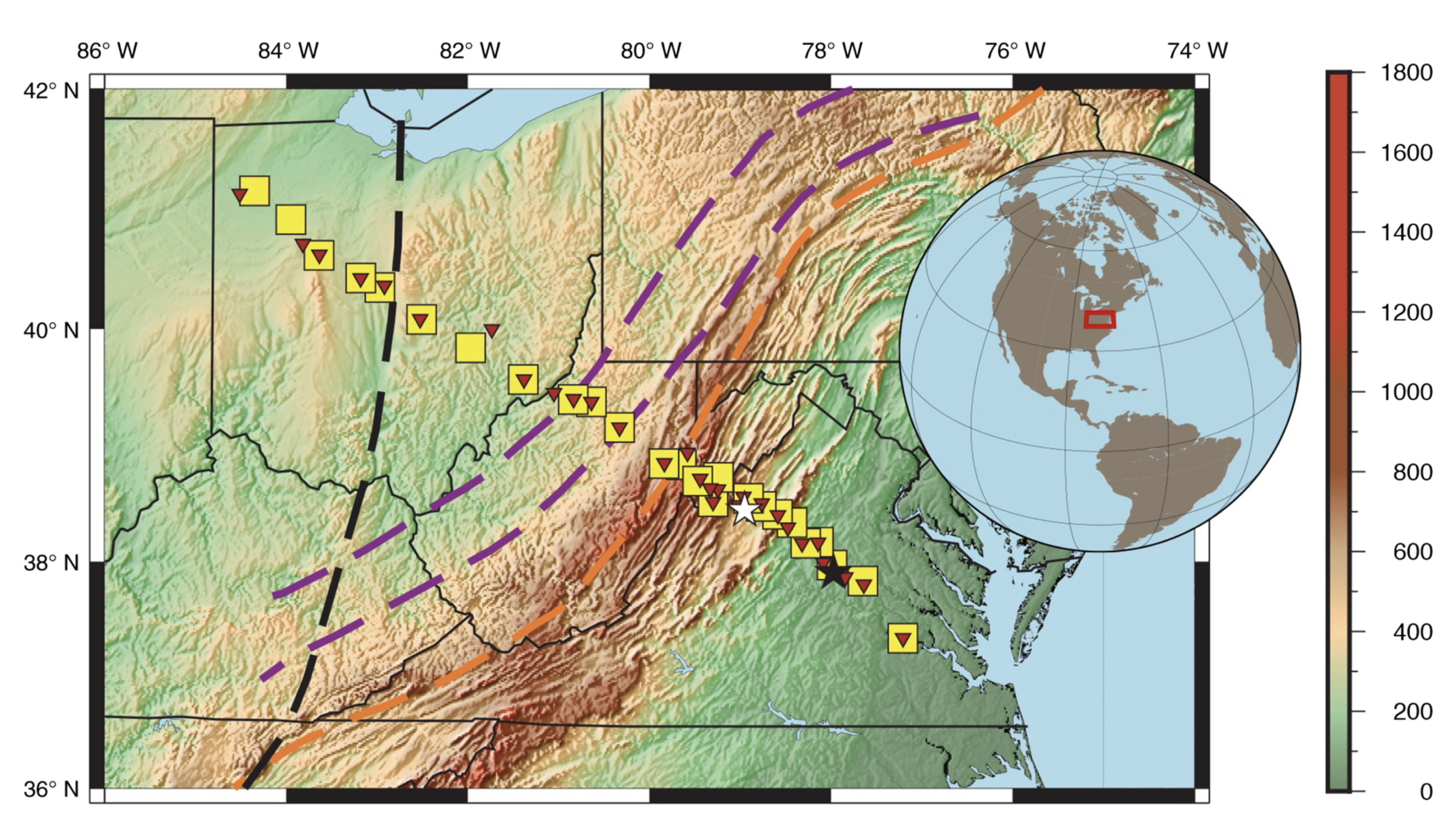

Map of the Mid-Atlantic Geophysical Integrative Collaboration, or MAGIC, seismic and magnetotelluric stations. Credit: Long et al., 2020
The MAGIC of multiple datasets in eastern North America
By Alka Tripathy-Lang
May 17, 2021
The MAGIC experiment allows scientists to see how complicated tectonic process manifest at deep levels of the eastern margin of North America. By linking the deep structure with surface observations “we can inform our views of the past processes.”
For the full story, head over to IRIS.